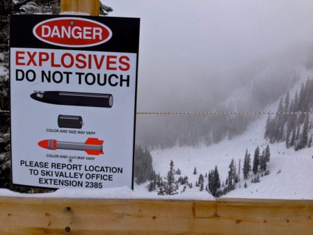
Ride the chairlift at Taos Ski Valley in New Mexico, and it’s clear you’re in serious ski terrain. At the top of Lift No. 2, a stuffed dummy clad in ski clothes, dubbed “Slidell,” lays face-first in the snow with a sign explaining how to stop yourself if you slide out of control. Black powder mars the snow, remnants of the explosives used to prevent surprise avalanches. Another sign warns skiers not to touch any undetonated explosives they might find on the mountain.

Image via flickr/Roy Luck
Topping out at 12,500 feet above sea level, Taos is extreme. Hard-core locals love the vertical double-black diamond terrain that gets more than 300 inches of snowfall each season. Yet those conditions add to the avalanche threat at Taos, which has 322 different avalanche paths. Multiple factors — new snowpack, accumulated weight, and rising temperatures, among others — can trigger an 80-mph slide at any time. Once the mass of snow stops sliding, it settles like concrete.
Keeping people safe? That falls to Rachel Moscarella.
As director of snow safety at the resort and a 27-year ski patrol veteran, Moscarella negotiates a complex, behind-the-scenes playbook that involves daily scouting by a team of experienced patrollers, a careful watch on snowpack and weather conditions, a few handheld bombs — and five Labrador retrievers — Hattie, Danin, Ozlo, June, and Izzy.
Prevention Is All in a Day’s Work
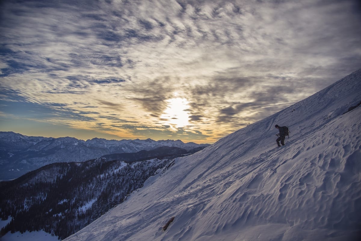
The workday begins each morning at 3:30 a.m., when Moscarella checks data from the resort’s weather and snow stations that record temperatures, wind speed and direction, snow depth, and water content. At 5:15 a.m., a team of bombers and snow safety experts hit the mountain via snowcat to dig pits to analyze the snow, make forecasts, prepare explosives and plan for the day’s avalanche mitigation. By 5:45 a.m., another eight to 15 patrollers will head out on skis on their regular routes, scanning for changes in terrain. They look for telltale signs of danger gleaned from years of experience: A pile of snow near the bottom of a run, or perhaps spots where the snow is collapsed, hollow or cracking.
Explosives are a common tool in avalanche mitigation, used by patrollers to preemptively trigger slides on precarious slopes.
Moscarella and her team keep tabs on conditions throughout the day, paying attention to factors like snow moisture, sun exposure, the layers and grain size of the snow, and air temperature to decide whether to close a run or keep it open.
Tools of the Avalanche Tracker’s Trade
Explosives are a common tool in avalanche mitigation, used by patrollers to preemptively trigger slides on precarious slopes. Weighing two to five pounds, the bombs are made of pentalite and TNT and use 90-second fuses. Some resorts now use drones, instead of humans, to drop bombs on certain avalanche-prone areas, but Moscarella has decided the weather conditions and federal regulations around explosives and air space made the new technology too unpredictable. “Plus, ski patrol wants to be on their skis, not flying a drone,” says Taos spokesman Dave Smith.

Image via Avalanche Mitigation Services
Sometimes the explosives don’t go off and get lost in the snow. “Dud hunters” search for them, but it’s not uncommon for them to go unnoticed until springtime. Hence, the warning signs for skiers.
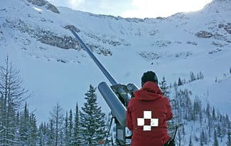
The resort also relies on two “avalaunchers” to trigger avalanches before Mother Nature does. The avalaunchers sit on 25-foot towers in the ski area and use compressed air to shoot a projectile onto a slope. They’ve been used since the 1960s for avalanche mitigation in extreme areas that cannot be reached by skiing or when the danger is so high that people shouldn’t even be on the ground.
In 2015, Taos invested in GIS mapping technology, which displays computerized maps of the resort on a big-screen TV inside the ski patrol hut. Last summer, the resort used an airplane and LiDAR (laser) mapping to collect detailed data on the topography of the terrain, rocks, and vegetation throughout the 1,294-acre property.
Moscarella and her team also use custom software, which records explosive use and avalanche occurrences, to digitize the bulk of the avalanche paths using a Web-based application. The patrollers use tablets to collect the information, which can then be viewed on a large screen inside the patrol hut.
 Ski patrollers got a new piece of gear this year in addition to the standard avalanche beacons, backpacks, probes and shovels: airbag vests to wear on their rounds. When a ripcord is pulled, the vests deploy airbags that allow the wearer to rise to the surface of the snow.
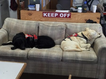
Perhaps the most unusual weapon in Moscarella’s arsenal? Labrador retrievers. The dogs often huddle on their special spots on the couch inside the ski patrol hut — but when there is an emergency, they’re all business. Equipped with beacons, probes and Recco detectors, the dogs can “show” a handler where someone was buried by picking up on a scent trail and indicating where to dig.
In fact, it’s framed photos of avalanche dogs, not Moscarella and her team, that line the wall of the ski patrol hut. Their pictures date back to Rocky, the first avalanche dog in 1980. They may very well be one of the best hopes to finding a buried person alive. “They are a terrific tool,” Moscarella says.


You should proofread your articles! The highest peak in New Mexico is Wheeler Peak; at 13,161′ above sea level, it’s north ridge and summit can be seen to the west from Taos Ski Valley’s slopes. The highest point within the ski area’s boundary is Kachina Peak, which is 12,481′ high according to the USGS surveys, not 13,500′ as stated in this article.
Also, it’s not proper to refer to TSV’s ski area as a “property”, as most of the acreage the resort uses is public land managed by the US Forest Service, and granted to the ski area to use per a Special Use Permit. Taos Ski Valley, Inc. does own part of the ski area’s lower mountain terrain in and above the base area villages. This is an important truth nowadays, as many privately owned ski resort businesses which operate on public lands tend to view the lands on which they are permitted to operate as their own, and this creates conflict among other land users, land managers (US Forest Service in the western states), and private interests.
Otherwise this is a good article. Rachel and her ski patrol peers at Taos are some of the best in the industry, they are experienced and now have the financial support to perform their duties using modern technology, and to keep their crew adequately staffed. As well they are working on establishing a proper avalanche forecasting entity which will provide information about current conditions in the local region that will be available to the public. All in all Taos Ski Valley, Inc. is making some profound steps now that the business is owned by a dedicated owner who loves skiing, equally loves and respects nature and wilderness, and has the financial resources necessary to grow this modest ski area into it’s full potential!
No critical comments from me. I found this post interesting, and I had not been aware of how well the dogs were equipped. Our mountains here in southern Michigan are not nearly as high, but still a lot of fun, and no avalanche hazard, at least most of the time.
Thanks for reading!