

 Where only a few years ago in-car Global Positional Systems were all the rage, today most techs heading out into the field can just as easily pull out their cell phone to look for driving directions.
And up until now, they’ve almost all relied on Google Maps to do that. Whether you use an Android phone or an iPhone, both have relied on Google software to track where they are and what’s close by. But that’s about to change, too. (Technology sure moves fast, doesn’t it?)
On Tuesday, Google announced a few updates to its mapping service, including 3D imaging in the Google Earth program, as well an “offline” mode that lets users save maps and call them up later, even if they don’t have an Internet signal. The timing of the announcement was hardly a coincidence: Apple is widely expected to announce its own mapping program, which will replace Google Maps in future iPhone and iPad models, at next week’s Worldwide Developer’s Conference.
From the Wall Street Journal:
- “Apple has quietly acquired at least three cutting-edge map companies, melding their technology with its own. Last fall, Apple took a first step in developing a proprietary mapping service with the virtually unnoticed release of a ‘geocoder’—the brains behind a mapping app that translates a phone’s longitude and latitude into a point on a map, like an address. Before that, it relied on Google’s geocoder.
- “But more than ad revenue, Apple is going after the map market to have more control over a key asset in the widening smartphone war. Google Maps is used by more than 90 percent of U.S. iPhone users. So Apple believes controlling the mapping experience and offering features that Google doesn’t have can help sell more devices and entice developers to build unique apps for iPhone users.”
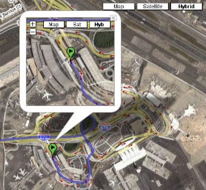
The budding arms race over digital mapping has huge implications for companies concerned with online advertising. But for mobile workers that rely heavily on GPS and smartphone maps for driving directions, the specter of a rival mapping service to Google Maps is promising. We’ve already seen these maps improve by leaps and bounds in recent years — from satellite imaging to real-time traffic conditions to now indoor mapping, which we’ve previously written about.
Three-dimensional mapping appears to be the next development, but what awaits us beyond that? With heavy hitters like Google and Apple driving mapping advancements, it’s probably safe to say we’re still in digital mapping’s infancy.
More: Could Indoor Mapping Hold Promise for Field Service?
Click here to download a free whitepaper, “Five Steps to Make Field Service Profitable.”

Share this: